Before you go
- Vehicle
- High-clearance recommended
- Permit
- Not required
- Entrance fee
- Expect separate museum, monastery, cave, protected-area, parking, or wine-tasting fees in Romanian lei; carry a backup card and some cash for smaller stops.
- Peak altitude
- 2500 m
- Cell coverage
- Patchy
- Fuel
- Start with a full tank in Bucharest and top up at larger towns before mountain, delta, forest, or rural segments.
- Road status
- Main approach roads are generally sealed, but mountain, monastery, lagoon, and rural access roads can deteriorate after rain, snow, or heavy weekend traffic.
- Closed months
- Jan, Feb, Mar, Apr, May, Nov, Dec
About this trip
This Bucharest-based route turns the research catalog for Transfăgărășan South-to-North and Bâlea Lake into a practical self-drive itinerary. It links the verified POIs in a start-to-finish sequence, keeps every stop anchored to local coordinates and attributed images, and leaves buffers for road delays, museum schedules, meals, and seasonal closures. The route is designed for English-language planning while preserving Romanian source coverage where it improves accuracy.
Route
Skip map, jump to step listWhere to sleep
- Night 1 of 1Lake Vidraru overnight baseHotelMid-range
Budget · ~150–300 RON/night. Mid-range · ~300–650 RON. Premium · ~650+ RON.
Itinerary

Stop 1
Bucharest
Start in central Bucharest and leave early for Transfăgărășan South-to-North and Bâlea Lake. Load offline maps, confirm parking options, and keep the first fuel stop flexible around morning traffic.
Tip: Start before rush hour when possible; Bucharest ring-road delays can change the whole day plan.
Stop 2
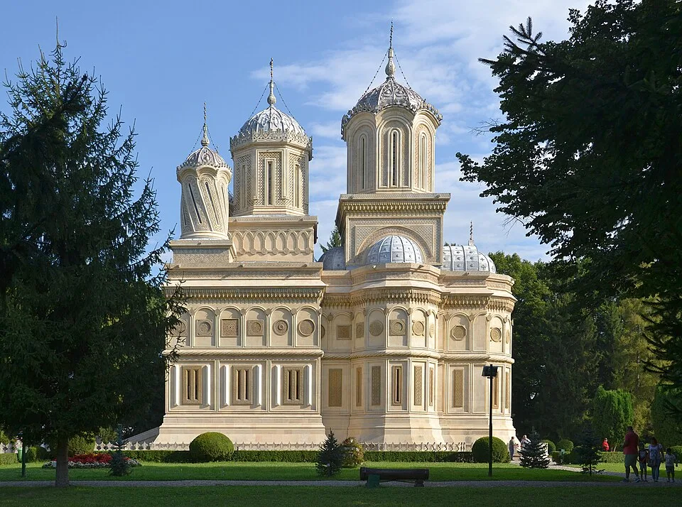
Curtea de Argeș
- From previous:
- 186 km · 202 min drive
- Stay:
- ~1.5 h
Former Wallachian princely seat and the gateway town for the southern Transfăgărășan The marker is placed from the research catalog and should be checked against current access conditions before.
Tip: Check current opening hours, road conditions, and ticket rules before departure.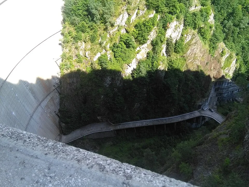
Stop 3
Vidraru Dam
- From previous:
- 34 km · 38 min drive
- Stay:
- ~1.5 h
166 m arch dam on the Argeș River, completed for the Vidraru hydroelectric scheme The marker is placed from the research catalog and should be checked against current access conditions before.
Tip: Check current opening hours, road conditions, and ticket rules before departure.
Stop 4
Lake Vidraru
- From previous:
- 4 km · 15 min drive
- Stay:
- ~1.5 h
Long artificial reservoir ringed by forested slopes and DN7C viewpoints The marker is placed from the research catalog and should be checked against current access conditions before.
Tip: Check current opening hours, road conditions, and ticket rules before departure.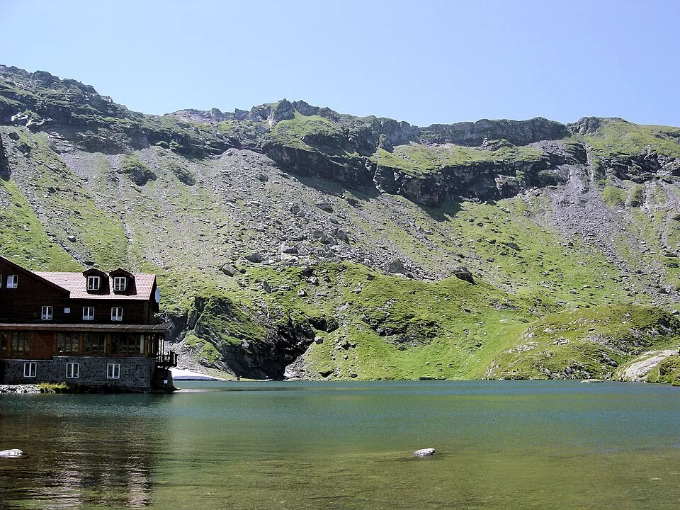
Stop 5
Bâlea Lake
- From previous:
- 32 km · 34 min drive
- Stay:
- ~1.5 h
Glacial lake at about 2,034 m in the Făgăraș Mountains with chalets, Salvamont presence, and major views The marker is placed from the research catalog and should be checked against current access conditions before.
Tip: Check current opening hours, road conditions, and ticket rules before departure.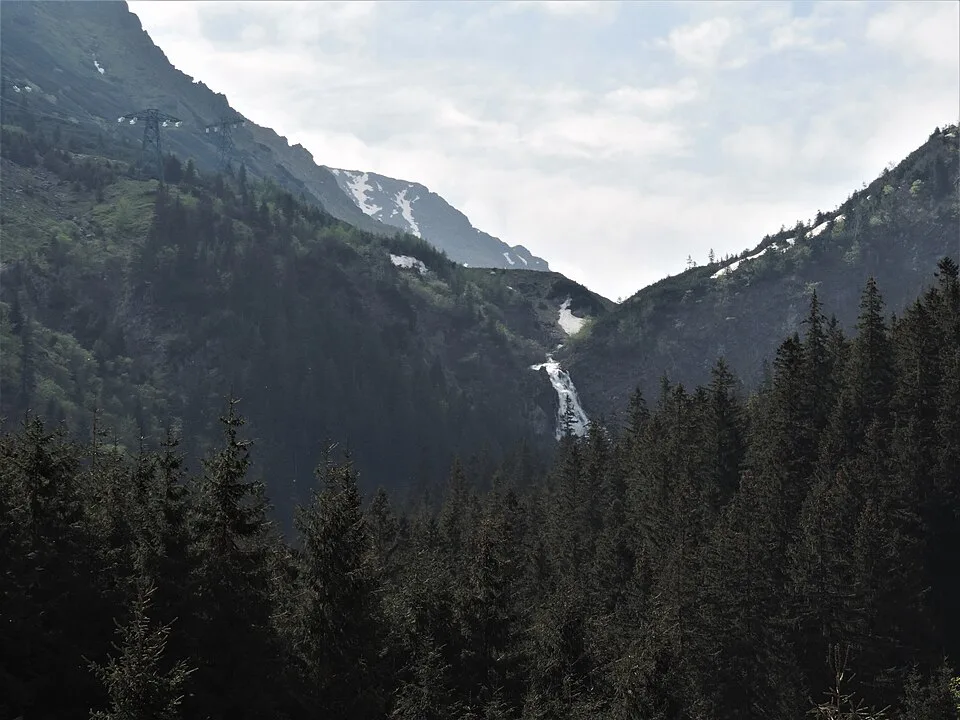
Stop 6
Bâlea Waterfall / Bâlea Cascadă
- From previous:
- 8 km · 15 min drive
- Stay:
- ~1.5 h
Waterfall and cable-car lower station on the Sibiu side, useful when the road above is closed The marker is placed from the research catalog and should be checked against current access conditions before.
Tip: Check current opening hours, road conditions, and ticket rules before departure.
Stop 7
Arefu
- From previous:
- 49 km · 53 min drive
- Stay:
- ~1 h
Optional nearby stop. Mountain commune below Poenari and Vidraru, a practical food/fuel/lodging checkpoint on DN7C The marker is placed from the research catalog and should be checked against current access conditions before.
Tip: Use this as a flexible buffer stop; verify opening hours locally before committing the day plan.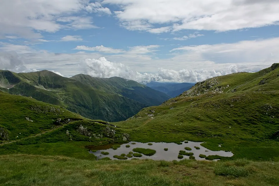
Stop 8
Capra Chalet Area
- From previous:
- 38 km · 41 min drive
- Stay:
- ~1 h
Optional nearby stop. Practical trailhead and accommodation zone below the Bâlea tunnel for Capra-side walks The marker is placed from the research catalog and should be checked against current access conditions before.
Tip: Use this as a flexible buffer stop; verify opening hours locally before committing the day plan.
Stop 9
Piscu Negru
- From previous:
- 4 km · 15 min drive
- Stay:
- ~1 h
Optional nearby stop. Southern high-road service/lodging cluster before the steeper Transfăgărășan alpine section The marker is placed from the research catalog and should be checked against current access conditions before.
Tip: Use this as a flexible buffer stop; verify opening hours locally before committing the day plan.
Stop 10
Prometheus / Electricity Monument
- From previous:
- 29 km · 31 min drive
- Stay:
- ~1 h
Optional nearby stop. Large metal figure above Vidraru Dam, often photographed with the reservoir and road The marker is placed from the research catalog and should be checked against current access conditions before.
Tip: Use this as a flexible buffer stop; verify opening hours locally before committing the day plan.
Stop 11
Return to Bucharest
- From previous:
- 211 km · 210 min drive
Return to Bucharest from the final stop on Transfăgărășan South-to-North and Bâlea Lake. Keep buffer time for village traffic, weather changes, and evening approaches to the capital.
Tip: Avoid arriving back during the tightest evening peak if the route crosses DN1, A1, A2, or the Bucharest ring road.
Night 1 of 1 · after Step 5: Bâlea Lake

Lake Vidraru overnight base
Practical overnight base around Lake Vidraru for the Transfăgărășan South-to-North and Bâlea Lake itinerary. This is a route-base placeholder; verify current hotels or guesthouses before booking.
- near route base
- parking
Use current local listings; availability changes by season.
What to bring
- Offline maps for the full route
- Romanian lei for parking, museums, and small local fees
- Water and snacks for rural stretches
- Comfortable walking shoes
- Layered clothing and rain shell
- Phone charger and power bank
- Vehicle documents and insurance
- Sunscreen and hat in summer
Sources
Researched from English and Romanian sources. Inaccuracies are mine.
- https://commons.wikimedia.org/wiki/File:Snagov_water_lilies.jpg
- https://commons.wikimedia.org/wiki/File:Church_of_the_Dormition,_Arge%C8%99_monastery_(by_Pudelek)_01.jpg
- https://commons.wikimedia.org/wiki/File:Vidraru_dam_jab_164924Pz.jpg
- https://commons.wikimedia.org/wiki/File:Baleasee.jpg
- https://commons.wikimedia.org/wiki/File:B%C3%A2lea_waterfall_kz01.jpg
- https://commons.wikimedia.org/wiki/File:Lake_Capra_(1).jpg
_01.jpg)
.jpg)
Similar trips
2 days
Bucegi plateau, Babele, Sphinx and Caraiman Cross
A 2-day Bucharest road trip to Bușteni, Babele and the Bucegi Sphinx, Heroes’ Cross on Caraiman Peak, covering about 340 km with 4 core stops.
2 days
Măcin Mountains granite ridges and the Lower Danube
A 2-day Bucharest road trip to Macin town, Greci / Tutuiatu trailhead, Culmea Pricopanului ridge, covering about 680 km with 5 core stops.
2 days
Piatra Craiului: Zărnești Gorge and Curmătura Hut
A 2-day Bucharest road trip to Zărnești, Piatra Craiului National Park Visitor Centre, Fântâna lui Botorog trailhead, covering about 395 km with 5 core stops plus 1 optional nearby POI stops.