
Overview
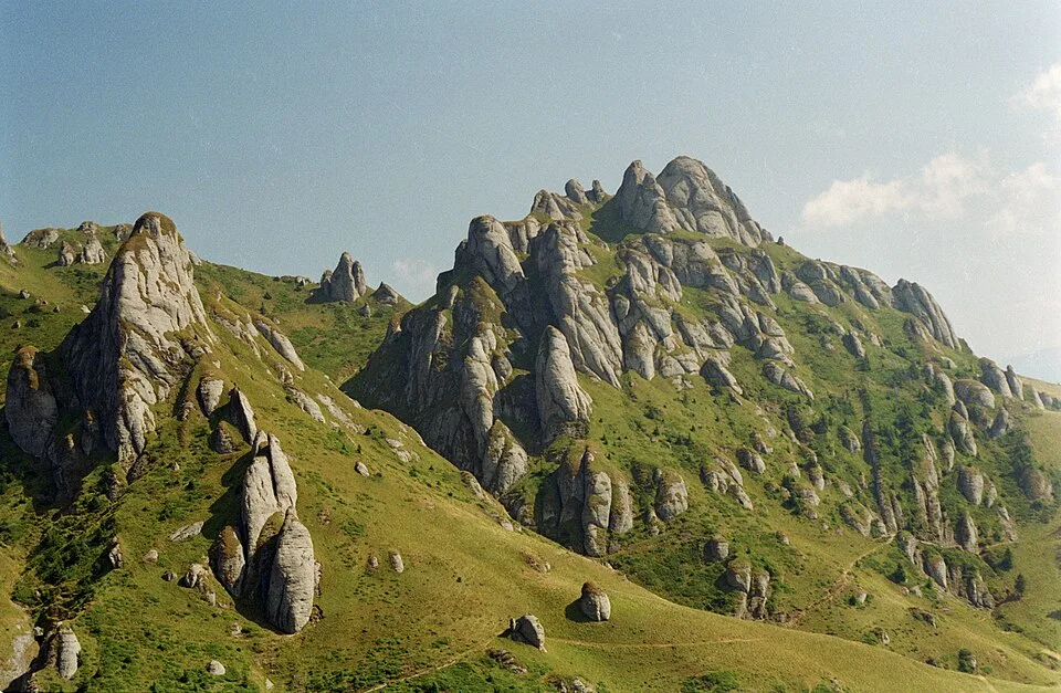
From Bratocea Pass on DN1A, the red-band trail leaves the road near a shepherds' stâna and climbs north on an old forestry track past a disused TV relay mast, breaking out of beech and spruce forest onto the open grass of Culmea Bratocei. The first landmark is Colții Bratocei, a cluster of weathered conglomerate spurs, followed by the broad grassy summit of Bratocea din Jos and the level shoulder of Vârful Bratocea, where the path contours just below the actual high point. Beyond Vârful Bratocea the ridge dips past the smaller rock cluster of Tigăile Mici before a final rocky pitch onto Tigăile Mari itself, a kilometre-long crest of Cretaceous conglomerate carved by frost, wind, and rain into mushroom caps, leaning pillars, and turrets up to 100 metres tall, the single most photographed formation in the Ciucaș range. The towers sit on the southern edge of the main ridge, and from among them the ground drops away into the forested bowl of the Chirușca valley, with the rooftops of Cheia and the headwaters of the Teleajen visible below and, on a clear day, the pale wall of the Bucegi massif rising on the horizon to the west. The return simply retraces the outbound ridge back to the pass on the same well-marked, rock-and-turf trail.
At a glance
- Distance
- 12 km
- Time
- 5 hr 30 min
- Elevation
- ↑ 640 m · 1263–1844 m
- Route
- Out and back
Route and directions
Numbered markers trace the waypoints from the trailhead. Use the buttons to open the trailhead in an external map app for driving directions. Links open in a new tab.
Access, season, and cautions
Access
From Brașov, drive southeast on DN1A through Săcele, about 30 km and 40-45 minutes on a paved but winding mountain road that climbs steadily to Bratocea Pass at 1,263 m, on the Brașov-Prahova county line. Park on the wide gravel shoulder at the pass; the marked trailhead starts opposite the old forestry track and there is no parking fee. The same DN1A continues south over the pass to Cheia and Măneciu in Prahova County, so the trailhead is equally reachable from that side.
No permit or entry ticket is required. The Tigăile rock towers and surrounding grassland form a protected geomorphological nature reserve within a Natura 2000 site, so camping, open fires, and off-trail scrambling among the fragile rock formations are prohibited; stay on the marked red-band trail.
Season: Late May through October is the reliable hiking season, with July through September the most stable stretch of weather on the open ridge. Snow can persist in shaded gullies near Vârful Bratocea into May, and afternoon thunderstorms build quickly on summer days, so an early start pays off. From November to April the ridge holds snow and ice and becomes a winter mountaineering route requiring crampons and an ice axe, not a hike to approach casually.
Cautions
- Fully exposed alpine ridge above Colții Bratocei with no forest cover: wind, fog, and lightning can build quickly, especially on summer afternoons.
- Loose scree and bare, weathered conglomerate slabs on the final approach to Tigăile Mari, slippery when wet or frosted.
- No water sources anywhere on the route; carry everything you need from the car at Bratocea Pass.
- Snow and ice can linger on shaded, north-facing sections into May, and the ridge is a serious winter mountaineering objective from November to April.
- The trail becomes hard to follow by feel alone among the maze of towers at Tigăile Mari; keep to the marked route if fog closes in.
Waypoints
- Trailhead: Bratocea Pass (DN1A) — Mountain pass at 1,263 m on the Brașov-Prahova county line; the red-band trail starts opposite the old forestry track and climbs north past a shepherds' stâna.
- Colții Bratocei — First rock landmark of the climb, a cluster of weathered conglomerate spurs around 1,570 m, including the Sfinxul and Porumbelul formations.
- Bratocea din Jos — Broad grassy summit at 1,772 m where the trail settles onto the open crest of Culmea Bratocei.
- Vârful Bratocea — Ridge shoulder at 1,837 m; the marked path contours just below the actual high point rather than crossing it directly.
- Tigăile Mici — Smaller rock cluster at about 1,825 m passed just before the main towers, a preview of the larger formation ahead.
- Tigăile Mari rock towers — Turnaround point: a kilometre-long crest of conglomerate towers up to 100 m tall at 1,844 m, with the Chirușca valley falling away to the south.
Gallery
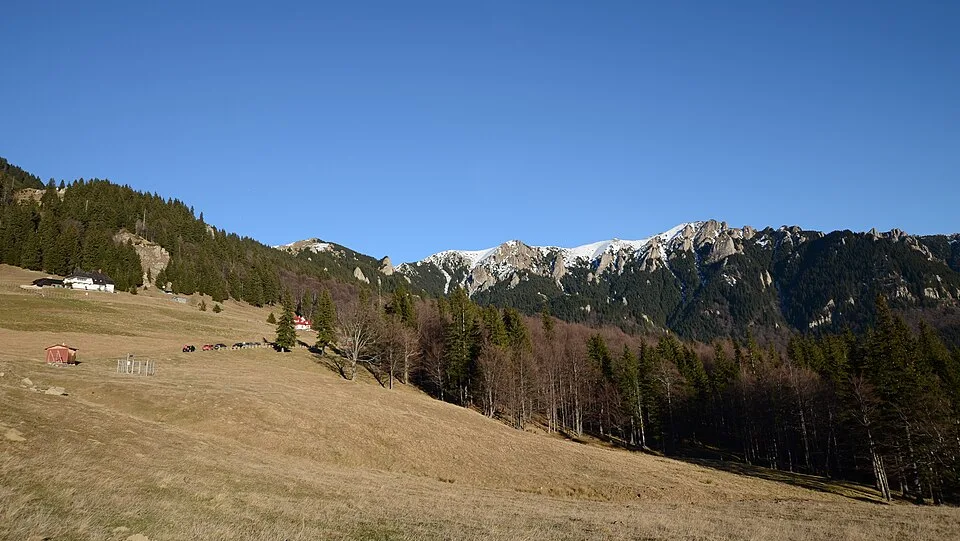
Culmea Gropșoarele-Zăganu by Razvan Socol, CC BY-SA 4.0, via Wikimedia Commons · CC BY-SA 4.0 · Source

Sources
- Ciucaș Mountains (en, retrieved 2026-07-02)
- Pasul Bratocea - Vârful Ciucaș - Pasul Tabla Buții (ro, retrieved 2026-07-02)
- Pasul Bratocea - Culmea Bratocea - Vârful Ciucaș - Cabana Ciucaș - Șaua Tigăilor și retur (ro, retrieved 2026-07-02)
- Tigăile Nature Reserve (en, retrieved 2026-07-02)
- Bratocea (peak profile) (en, retrieved 2026-07-02)