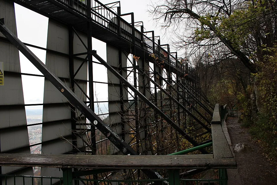
_(51879941296).jpg)
Overview
Drumul Serpentinelor (the Serpentine Road), marked with a red triangle, leaves Parcul Tiberiu Brediceanu at the southern foot of the fortress walls near the old Bastionul Postăvarilor and climbs in roughly 13 tight switchbacks cut into the hillside in 1837. The path passes close to the base station of the Tâmpa cable car and the parallel stone steps of Treptele lui Gabony before both routes merge higher up, then continues past a junction with the historic Drumul Cavalerilor (the medieval Knights' Road) and an overlook near the upper switchbacks that gives the first uninterrupted view over the city. From the summit terrace, next to the television tower, the Panoramic restaurant and the ruins of the old Brasovia hill-fort, the view opens north over Brașov's old town: the steep red-tiled roofs, the dark spire of the Black Church, and the arcaded façades around Council Square sit tightly inside the medieval walls, with the flat Bârsa Depression stretching away toward the distant Carpathian ridges. Immediately behind the terrace, to the south and southwest, rises the forested bulk of the wider Postăvarul massif, of which Tâmpa itself is the outlying northern summit. Tâmpa is a limestone outcrop covered in beech and oak forest and protected as a nature reserve for its butterflies, birds and occasional bears, so the climb feels wilder than its short length and city-centre start suggest. Most hikers go up and down the same trail, though the steeper stone steps of Treptele lui Gabony offer a shorter, rougher alternative for the descent.
At a glance
- Distance
- 6 km
- Time
- 2 hr 25 min
- Elevation
- ↑ 380 m · 640–960 m
- Route
- Out and back
Route and directions
Numbered markers trace the waypoints from the trailhead. Use the buttons to open the trailhead in an external map app for driving directions. Links open in a new tab.
Access, season, and cautions
Access
The trailhead is inside Brașov itself, on Aleea Tiberiu Brediceanu at the edge of Parcul Tiberiu Brediceanu, about a 10-15 minute walk south from Piața Sfatului through the old town streets, so no highway drive is needed once you are in the city. Arriving by car from Bucharest or the Prahova Valley, follow DN1/E60 north through Predeal into Brașov (about 170 km, 2.5-3 hours from Bucharest), then head into the old town; paid on-street and small lot parking is available near the fortress walls and along Aleea Tiberiu Brediceanu, though spaces fill up on summer weekends. The Tâmpa cable car (telecabina), which departs from the same area, is a fair-weather alternative for the ascent or descent if you would rather walk only one direction.
No permit or fee is required to hike the trail. Tâmpa is a protected nature reserve, so stay on the marked red-triangle path, keep dogs leashed, do not pick plants or disturb wildlife, and pack out all rubbish.
Season: Walkable all year since the trail starts in the city itself, but conditions on the switchbacks vary a lot by season. Spring and after summer storms leave the packed-earth and stone sections muddy and slippery; July and August are busiest, hot on the exposed upper switchbacks, and the time of year most likely to bring afternoon thunderstorms. From roughly December through March the shaded upper stretches can ice over, making the iron handrails on the steepest pitches essential and light crampons or trekking poles a good idea.
Cautions
- Worn stone steps and loose gravel on the switchbacks, especially on Treptele lui Gabony, become slick after rain; iron handrails help on the steepest pitches but sturdy, grippy footwear is important.
- Tâmpa's forest is a protected reserve home to brown bears, wild boar and occasionally lynx; a bear was photographed crossing the Serpentine trail in June 2021, so make noise on the way up and avoid hiking alone at dawn or dusk.
- No drinking-water fountains along the route; carry what you need, particularly in summer heat on the more exposed upper switchbacks.
- Sudden summer thunderstorms build quickly over the Bârsa Depression in the afternoon; start early and get off the ridge before storms roll in.
- The trail is popular with casual city walkers in street shoes who sometimes underestimate the steady climb; pace yourself and turn back if conditions or fitness are not matching expectations.
Waypoints
- Trailhead: Aleea Tiberiu Brediceanu (Bastionul Postăvarilor) — Marked start of Drumul Serpentinelor at the edge of Parcul Tiberiu Brediceanu, a 10-15 minute walk south of Piața Sfatului; red-triangle markers begin here at roughly 640 m.
- Cable-car base station (Casa Pădurarului) — Lower station of the Tâmpa telecabina, where the Serpentine trail runs close to the parallel stone steps of Treptele lui Gabony before the first switchbacks proper begin.
- Drumul Cavalerilor junction — Stone-bench junction, roughly the fifth switchback, where the historic Knights' Road (Drumul Cavalerilor) branches off; keep following the red-triangle markers uphill.
- Upper switchback overlook — Around the upper switchbacks of Drumul Serpentinelor, the trees open briefly for the first clear view down over Brașov's old town roofs.
- Crucea Tâmpa (Tâmpa Cross) — Marble cross erected in 2001 on the summit ridge, just below the final approach to the peak.
- Vârful Tâmpa summit (960 m) — Wooded summit with the TV tower, the Panoramic restaurant, remains of the old Brasovia hill-fort, and the viewing terrace over the old town; turn around here to retrace the trail down.
Gallery
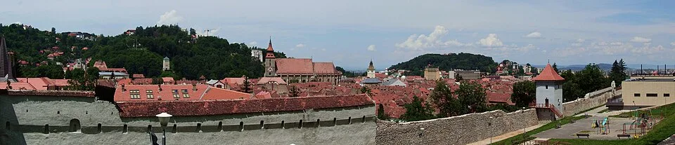
Brașov panorama by Pudelek (Marcin Szala), CC BY-SA 3.0, via Wikimedia Commons · CC BY-SA 3.0 · Source

Sources
- Brașov (centru) - Drumul Serpentinelor - Vf. Tâmpa (ro, retrieved 2026-07-02)
- Tâmpa (Brașov) (en, retrieved 2026-07-02)
- Mount Tampa Brasov – Mountain Hiking Trails & Cable Car (en, retrieved 2026-07-02)
- Hiking Tâmpa Mountain from Brașov Old Town (en, retrieved 2026-07-02)
- Tâmpa (en, retrieved 2026-07-02)