Overview
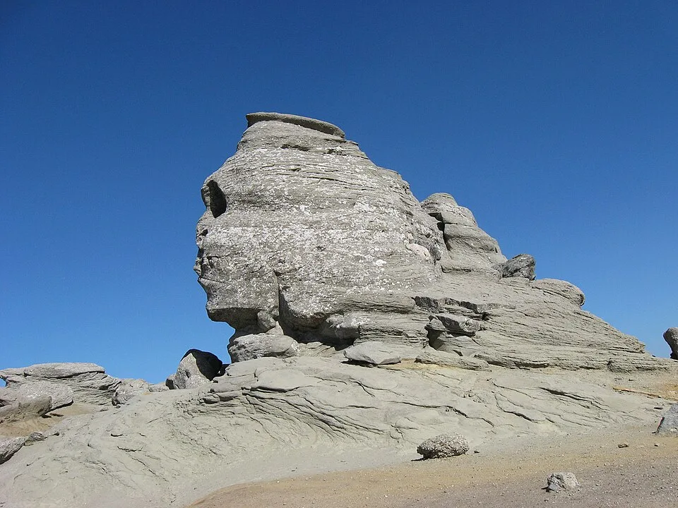
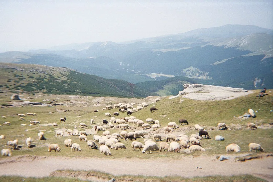
From the Babele cable-car station, this route leaves the day-trip crowds behind almost immediately, following the yellow-stripe trail north across the open, treeless Bucegi plateau past the wind-carved Sphinx rock formation and over the broad saddle of Șaua Șugărilor. The trail then narrows along Cerdacul Obârșiei, a limestone balcony perched on the plateau's western rim, where the ground falls away toward the headwaters of the Ialomița far below; on a clear day the river's source basin unspools to the west while the pale wall of Piatra Craiului rises beyond it on the horizon. Beyond Cerdacul Obârșiei the path crosses the Bucura-Dumbravă basin to Cabana Omu, the highest mountain hut in the Carpathians, before a short final pull to Vârful Omu itself, the Bucegi's highest point at an accepted 2,505 m, topped by a weather station and a 360-degree panorama over the whole massif. The entire walk stays above 2,100 m on rolling alpine tundra with no shade, no reliable water, and no shelter beyond the hut, so it feels far more serious than its modest distance suggests.
At a glance
- Distance
- 11 km
- Time
- 4 hr
- Elevation
- ↑ 500 m · 2150–2505 m
- Route
- Out and back
Route and directions
Numbered markers trace the waypoints from the trailhead. Use the buttons to open the trailhead in an external map app for driving directions. Links open in a new tab.
Access, season, and cautions
Access
From Brașov, drive south on DN1/E60 through Predeal to Bușteni, about 37 km and 45 minutes. Park at the pay lot by the Telecabina Bușteni-Babele base station at the edge of town (arrive by 8:00-8:30 a.m. in summer, before it fills) and ride the two-stage cable car up about 1,235 m of ascent to the Babele top station at about 2,200 m, where the marked trail to Omu begins. Climbing on foot from the valley instead, via Valea Cerbului or Poiana Izvoarelor, adds about 1,200 m of extra elevation gain and several more hours, and is effectively a separate, harder route.
Bucegi Natural Park requires a paid visitor ticket (10 RON per adult as of 2026, valid three months; children under 14 free), purchased online or in cash from park rangers. No separate hiking or climbing permit is needed for this route. Stay on the marked yellow-stripe trail, especially along Cerdacul Obârșiei and the summit plateau, which lie within protected natural reserve zones where off-trail travel, camping, and open fires are restricted.
Season: Late June through early October offers the most reliable footing and least snow, with July and August the busiest and calmest window for the exposed plateau. Snow patches can persist in shaded dips near Cerdacul Obârșiei into June, and a summer snow squall above 2,000 m is possible in any month. Outside this window the plateau becomes a genuine winter mountaineering objective with ice, wind slab, and whiteout risk, not a hike to attempt on cable-car access alone. The Bușteni-Babele cable car itself can close for high wind or scheduled maintenance (commonly Tuesdays), so confirm it is running before you drive up.
Cautions
- Fully exposed, treeless terrain the entire way: fog, high wind, and lightning can arrive within minutes on the open plateau, with no shelter between the Sphinx and Cabana Omu.
- Cliff-edge exposure along the narrow limestone balcony at Cerdacul Obârșiei, where the plateau drops away toward the Ialomița valley.
- Snow and ice can linger on the trail into June, and summer snow squalls above 2,000 m are not unusual even in July and August.
- The Bușteni-Babele cable car, the only practical approach, can suspend service in high wind or for maintenance, potentially stranding hikers on the plateau.
- No reliable mobile signal and no water sources along most of the route; carry all the water you need.
Waypoints
- Trailhead: Babele (cable-car top) — Top station of the Bușteni-Babele cable car at about 2,200 m; the yellow-stripe trail to Omu starts here, crossing the open Bucegi plateau.
- Sfinxul (the Sphinx) turn-off — Wind-carved rock silhouette passed within the first few minutes of the walk, just north of the Babele station.
- Șaua Șugărilor saddle — Broad grassy saddle where the trail settles into a long, gently undulating traverse across the high plateau.
- Cerdacul Obârșiei limestone balcony — Narrow ledge along the plateau's western rim; the most exposed stretch of the route, with sweeping views west over the Ialomița headwaters.
- Bucura-Dumbravă basin, near Cabana Omu — Last high basin before the final climb, with Cabana Omu, the highest mountain hut in the Carpathians, visible ahead.
- Summit: Vârful Omu (2505 m) — Highest point in the Bucegi Mountains, marked by a meteorological station; turnaround point of the hike.
Gallery


Sources
- Hiking to Omu Peak: The highest point in the Bucegi Mountains (en, retrieved 2026-07-02)
- Omu Peak (en, retrieved 2026-07-02)
- Ticket information (en, retrieved 2026-07-02)
- Distanța Bușteni Brașov (ro, retrieved 2026-07-02)