
Overview
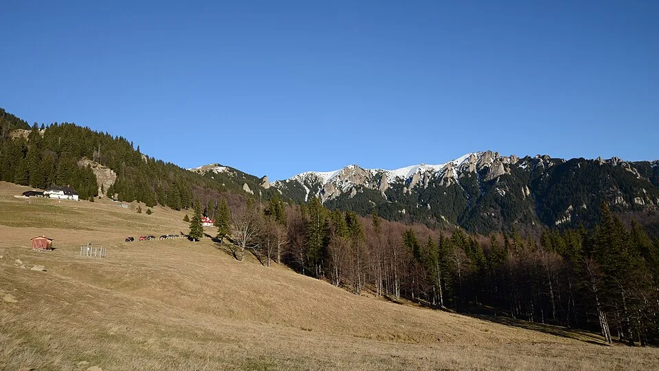
From the parking area at the former Cabana Muntele Roșu (1,270 m), a red-triangle trail climbs steadily through spruce and beech forest onto the open shoulder of Vârful Muntele Roșu (1,765 m), then follows the broad grassy crest to the saddle of La Răscruce (1,805 m), where the trail toward Cabana Ciucaș splits off. From La Răscruce a short, steeper pull reaches Vârful Gropșoarele (1,883 m), the second-highest summit in the Ciucaș massif and the turnaround point for many day hikers. The fuller route continues south along the narrow, rocky spine toward Vârful Zăganu (1,817 m), crossing the wind-carved rock towers of Colții Zăganului on a short, chain-protected passage known locally as 'la lanțuri.' Standing among these rock teeth, the ridge falls away in steep, spruce-covered slopes to the southwest toward the roofs of Cheia village in its valley, the weathered grey spires of Ciucaș Peak rise to the northwest, and the long forested folds of the Munții Siriului fade into haze to the east — a panorama local guides describe as a miniature version of Piatra Craiului and the Făgăraș crest compressed into a few kilometers of ridge. The hike retraces the same trail back down to the cabin. Above the tree line there is no shade, no marked water source, and often no mobile signal, so the modest distance belies a serious mountain day.
At a glance
- Distance
- 11.8 km
- Time
- 7 hr
- Elevation
- ↑ 950 m · 1270–1883 m
- Route
- Out and back
Route and directions
Numbered markers trace the waypoints from the trailhead. Use the buttons to open the trailhead in an external map app for driving directions. Links open in a new tab.
Access, season, and cautions
Access
From Brașov, drive east on DN1A through Tărlungeni and Săcele, over the Bratocea pass, to the resort village of Cheia — about 50 km and roughly an hour's drive. About 3 km before Cheia, turn off DN1A onto the signed, paved side road that climbs about 4 km to the former Cabana Muntele Roșu (1,270 m); the open ground around the old cabin serves as trailhead parking. The cabin building itself is not reliably staffed or stocked, so treat it as a parking area and landmark rather than a place to buy food or water.
No entry ticket or hiking permit is required. The Ciucaș massif is protected as the Natura 2000 site ROSCI0038 rather than as a fee-charging national park, so access is free, but hikers should stay on the marked trail, pack out all trash, and avoid picking rhododendron or other protected alpine flora.
Season: Best from June through September, when the ridge is snow-free and the trail is driest; early June also brings the region's rhododendron bloom to the upper slopes. Snow can linger in shaded gullies near Colții Zăganului into May, and the chain-protected passage becomes a genuine winter mountaineering problem with ice and wind slab from November to April, not something to attempt in ordinary trail shoes. Afternoon thunderstorms build quickly in summer, so start early and plan to be off the exposed crest by early-to-mid afternoon.
Cautions
- A short but genuinely exposed rock-tower passage at Colții Zăganului, secured only by an old fixed chain, on the ridge between Vârful Gropșoarele and Vârful Zăganu.
- Fast-changing mountain weather: fog, high wind, and afternoon thunderstorms can arrive within minutes on the open crest, with little shelter between the tree line and the ridge.
- Loose scree and eroded, slippery sections on the steeper climbs and descents, especially after rain.
- No reliable water source above Cabana Muntele Roșu; carry everything you need for the day.
- Brown bears are present in the forested lower slopes around Cheia and Muntele Roșu; hike in a group and make noise on the forested approach.
- Sparse waymarking around the rock towers makes route-finding difficult in fog; carry a map, compass, or GPS track.
Waypoints
- Trailhead: Cabana Muntele Roșu (1,270 m) — Former mountain cabin off DN1A near Cheia; the open ground around it serves as trailhead parking. Red-triangle markers begin the climb here.
- Vârful Muntele Roșu (1,765 m) — Open, grassy ridge shoulder reached after the steady forest climb; the trail continues east along the broadening crest.
- Șaua La Răscruce (1,805 m) — Saddle junction where the trail to Cabana Ciucaș splits off; this route continues south toward Gropșoarele.
- Vârful Gropșoarele (1,883 m) — Second-highest summit in the Ciucaș massif, and the turnaround point for many day hikers; the ridge narrows noticeably beyond here.
- Colții Zăganului rock towers — Wind-carved rock towers on the narrow ridge crest; a short exposed passage here is secured by an old fixed chain ('la lanțuri').
- Vârful Zăganu (1,817 m) — Southern high point of the ridge and the hike's turnaround; retrace the same trail back to Cabana Muntele Roșu.
Gallery
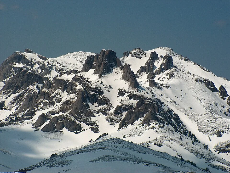
Ciucas by Mlefter, CC BY-SA 3.0, via Wikimedia Commons · CC BY-SA 3.0 · Source

Sources
- Ciucaș: Cabana Muntele Roșu - Vârful Gropșoarele. Traseu de o zi (ro, retrieved 2026-07-02)
- Ciucaș Mountains (en, retrieved 2026-07-02)
- Creasta Gropșoarele - Zăganu (ro, retrieved 2026-07-02)
- O zi în Ciucaș pe Creasta Zăganului (ro, retrieved 2026-07-02)
- Ciucaș (sit Natura 2000 ROSCI0038) (ro, retrieved 2026-07-02)