
Overview
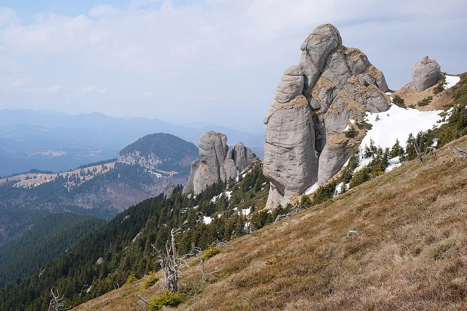
From the gravel parking area at Cabana Muntele Roșu (1,280 m), reached by paved road off DN1A near Cheia, a yellow-band trail follows the Berii stream up through spruce forest, crossing the water at a forest-road junction before climbing past the stone-capped Fântâna Nicolae Ioan spring, the last reliable water source on the route. Above the spring the path leaves the streambed and switchbacks steeply up the valley wall, gaining most of its elevation on a series of tight forest-road hairpins before breaking out of the trees near Cabana Vf. Ciucaș (1,595 m), an alpine hut set in a high meadow below the summit cone. From the hut the trail turns to red-stripe waymarks and climbs the last, steepest stretch through the Babele la Sfat, a pair of weathered conglomerate megaliths that give the final approach its name, before a short rock scramble onto the summit block itself. On top, weathered grey conglomerate boulders frame a genuinely wide panorama: the jagged limestone crest of Piatra Craiului stands out to the west, the forested Baiu (Gârbova) ridges roll away to the west-southwest while the Postăvaru ridge rises northwest toward the Bârsa depression and Brașov, and to the south-southwest the roofs of Cheia and the switchbacks of DN1A sit far below at the foot of the mountain. The whole upper mountain lies within the Ciucaș Natura 2000 protected site, and because the conglomerate bedrock is too porous to hold groundwater, there are no further springs above Fântâna Nicolae Ioan, so hikers carry all the water they need for the upper half of the climb.
At a glance
- Distance
- 15 km
- Time
- 6 hr 40 min
- Elevation
- ↑ 950 m · 1280–1954 m
- Route
- Out and back
Route and directions
Numbered markers trace the waypoints from the trailhead. Use the buttons to open the trailhead in an external map app for driving directions. Links open in a new tab.
Access, season, and cautions
Access
From Brașov, drive southeast on DN1A through Tărlungeni and Săcele and over Pasul Bratocea toward Cheia, about 45 km and roughly an hour on a paved but winding mountain road. A signed side road climbs about 3 km from DN1A, just before the Cheia resort, to Cabana Muntele Roșu (1,280 m), where there is a large gravel parking area; this is the trailhead. The onward forest road toward Cabana Vf. Ciucaș is passable only to high-clearance 4x4 vehicles, so almost everyone walks the whole route from the Muntele Roșu car park.
No permit or entry ticket is required. The upper mountain lies within the Ciucaș Natura 2000 protected site (ROSCI0038); stay on the marked yellow-band and red-stripe trails, do not climb on or damage the conglomerate rock formations, do not pick alpine flowers, light no open fires, and pack out all rubbish.
Season: Best from mid-June through September, when the trail is dry and the alpine meadows around Cabana Vf. Ciucaș are in bloom; snow can linger into May on shaded switchbacks below the treeline. From November to April the upper mountain holds deep snow and ice, and the rocky final approach to the summit becomes a genuine winter mountaineering objective requiring crampons rather than a hiking-boots outing. Afternoon thunderstorms build quickly on summer days on this exposed summit block, so start early and plan to be off the top well before midday heat builds into storms.
Cautions
- The final approach to the summit is a genuine rock scramble through the Babele la Sfat towers; wet or icy conglomerate is slippery, and a slip on the exposed sections could cause a serious fall.
- There is no reliable water source above Fântâna Nicolae Ioan in Valea Berii, since the porous conglomerate bedrock holds almost no groundwater; carry all the water needed for the upper half of the climb.
- Summer afternoon thunderstorms bring real lightning risk on the open, treeless summit block; start early and be off the top before storms typically build.
- Fog and sudden weather changes are common on the exposed upper slopes and can drop visibility to a few metres within minutes, making the switchback trail easy to lose.
- Snow and ice can linger on shaded switchbacks into May and return by November; outside the summer season the route requires crampons and winter mountaineering experience, especially on the rocky final climb.
- The forest road above Cabana Muntele Roșu carries occasional 4x4 traffic; stay alert where the marked trail shares the roadbed.
Waypoints
- Trailhead: Cabana Muntele Roșu (1,280 m) — Gravel parking area at the mountain hut off DN1A near Cheia; the yellow-band trail up Valea Berii begins here.
- Valea Berii forest-road junction — Crossing of the Berii stream where the trail settles into the valley and begins its steady climb through spruce forest.
- Fântâna Nicolae Ioan spring — Stone-capped memorial spring in Valea Berii, the last reliable water source before the switchback climb.
- Lower switchback bend — First of several tight, steep forest-road hairpins that gain most of the route's elevation out of the valley.
- Upper switchback bend — Trail breaks out of dense forest onto more open slope as the switchbacks near the alpine meadow.
- Cabana Vf. Ciucaș (1,595 m) — Alpine hut in a high meadow below the summit cone; waymarking changes to red stripe for the final climb.
- Babele la Sfat rock towers — Pair of wind- and rain-carved conglomerate megaliths on the steep, rocky final approach to the summit.
- Vârful Ciucaș (1,954 m) — Highest point of the Ciucaș Mountains, marked by weathered conglomerate blocks and a wide panoramic view.
Gallery
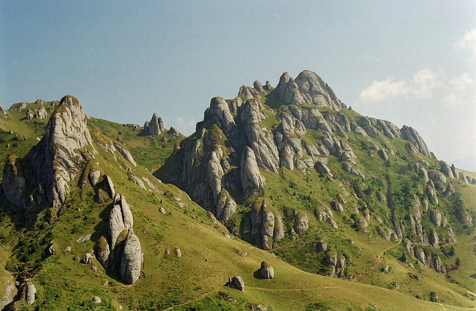
Ciucaș mountains by Petr Vodička, CC BY-SA 4.0, via Wikimedia Commons · CC BY-SA 4.0 · Source

Sources
- Vârful Ciucaș, Masivul Ciucaș (ro, retrieved 2026-07-02)
- Cheia - Cabana Muntele Roşu - Cabana Vârful Ciucaş (ro, retrieved 2026-07-02)
- ACTIVITĂȚI (ro, retrieved 2026-07-02)
- Traseu Cabana Ciucas - Varful Ciucas 1954 m (ro, retrieved 2026-07-02)
- Cabana 'Muntele Roşu' (1280 m) (ro, retrieved 2026-07-02)
- Ciucaș (sit Natura 2000 ROSCI0038) (ro, retrieved 2026-07-02)