
Overview
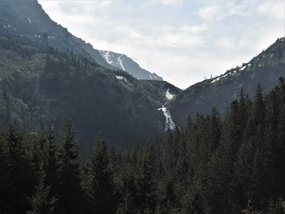
From the lower station of the Bâlea Lake cable car, right beside the Bâlea Cascadă chalet on the Transfăgărășan (DN7C), a red-dot marked path crosses the Bâlea stream on a wooden footbridge and climbs steadily into spruce forest. The trail tightens into narrow, boulder-strewn switchbacks as it gains height, the roar of falling water growing louder with every turn, before opening onto a viewing terrace directly beneath the falls. From this upper terrace, the trail's turnaround point, the full 60-metre stepped drop of Bâlea Waterfall is visible close up: sheets of white water fan out and crash down dark, moss-slicked gneiss and mica-schist ledges in a broad staircase, throwing spray into the air, with the bare, sometimes snow-streaked ridgelines of the Bâlea glacial cirque rising above the tree line. The waterfall is fed from Bâlea Lake, some 800 vertical metres higher at the top of the Transfăgărășan pass, and is regarded as the largest stepped waterfall in Romania. Because the drive already climbs to about 1,234 m, the walking itself is short and the elevation gain modest, though the final stretch of loose, wet rock demands sturdy footwear and unhurried footing.
At a glance
- Distance
- 3 km
- Time
- 1 hr 45 min
- Elevation
- ↑ 350 m · 1234–1580 m
- Route
- Out and back
Route and directions
Numbered markers trace the waypoints from the trailhead. Use the buttons to open the trailhead in an external map app for driving directions. Links open in a new tab.
Access, season, and cautions
Access
From Brașov, drive west on E68/DN1 through Făgăraș and Avrig to Cârțișoara, about 104 km and roughly 1 hour 30 minutes, then turn south onto DN7C (Transfăgărășan) and climb about 21 km of switchbacks to the Bâlea Cascadă cable car base station — around 125 km and 2 hours total from Brașov. Park in the pay area beside the chalet and cable car station; the red-dot trail to the waterfall starts right there, so no further driving or approach walk is needed. The same base station is also the departure point for the Bâlea Lake cable car if you want to continue higher.
No permit is required. The trail lies within Sibiu County's stretch of the Făgăraș Mountains, part of the Natura 2000 protected network, so stay on the marked red-dot path, do not climb on the wet rock beyond the viewing terrace, avoid disturbing wildlife, and pack out all rubbish.
Season: The DN7C road from Cârțișoara up to Bâlea Cascadă is kept open through most of the year and the cable car runs year-round, weather permitting, but the higher continuation of the Transfăgărășan over the pass to Bâlea Lake is normally closed by snow from around late October to late June, so plan to turn back at the waterfall outside summer. The forest trail itself is best walked June through September; from October to May the boulders and switchbacks near the top can carry ice and old snow, and the spray zone at the base freezes into a slick glaze in cold weather, both calling for grippy boots or microspikes. Afternoon thunderstorms are common on summer visits, and low cloud can settle in the gorge with little warning.
Cautions
- The path is narrow, uneven and littered with large boulders that turn slick with spray or after rain, especially on the final switchbacks near the falls.
- The steep, tightly switchbacked upper section has loose gravel and eroded steps that call for careful footing in both directions.
- Brown bears are regularly reported in this forested stretch of the Bâlea valley; hike after mid-morning once foot traffic has picked up, make noise on the approach, and avoid hiking alone at dawn or dusk.
- The trail is narrow and can be crowded with cable-car day-trippers in July and August, requiring single-file yielding on tight sections.
- Mountain weather changes quickly even in summer; afternoon thunderstorms and sudden fog are common, and the open viewing terrace at the base of the falls offers no shelter from lightning.
Waypoints
- Trailhead: Bâlea Cascadă lower cable car station (1234 m) — Lower station of the Bâlea Lake cable car on DN7C (Transfăgărășan), beside the Bâlea Cascadă chalet; parking, food stalls, and the start of the red-dot trail.
- Footbridge over the Bâlea stream — The red-dot trail crosses the Bâlea stream on a wooden footbridge just above the chalet and begins climbing into spruce forest.
- Switchbacks through spruce forest — A steepening, boulder-strewn path climbs in tight switchbacks alongside the stream, with the sound of the falls growing louder.
- Lower viewing clearing — A small clearing gives the first unobstructed view across the valley of the falls' full stepped drop.
- Base of Bâlea Waterfall (turnaround, ~1580 m) — Viewing terrace at the foot of the main 60-metre cascade, close enough to feel the spray; the trail's high point and turnaround for the return to the cable car station.
Gallery
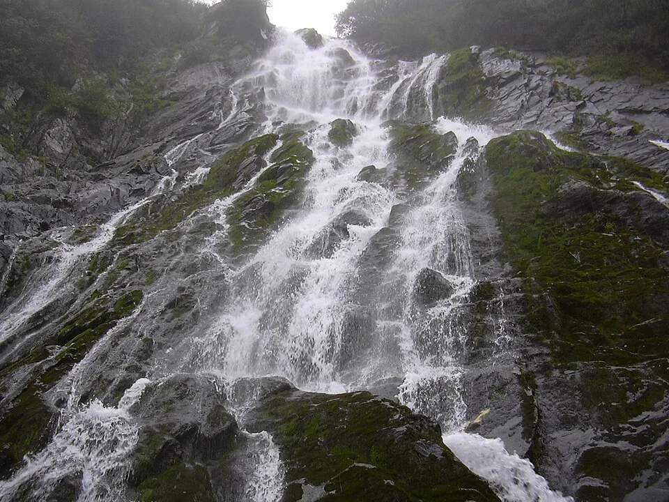
The Bâlea Cascade — Jopsens, CC BY-SA 3.0, via Wikimedia Commons · CC BY-SA 3.0 (GFDL also listed) · Source

Sources
- Cascada Bâlea (ro, retrieved 2026-07-02)
- Hike to Balea Waterfall, Fagaras Mountains (en, retrieved 2026-07-02)
- Cascada Balea (en, retrieved 2026-07-02)
- Balea Lake - Balea Waterfall Cablecar - Fagaras Mountains (en, retrieved 2026-07-02)
- Distanța Brașov Cârțișoara (ro, retrieved 2026-07-02)
- Munții Făgăraș (ro, retrieved 2026-07-03)
- Open-Elevation SRTM lookup at Bâlea Waterfall base coordinates (en, retrieved 2026-07-03)
- Reverse geocode of the Bâlea Cascadă cable car base station (en, retrieved 2026-07-03)
- Stația telecabină Bâlea Cascadă (en, retrieved 2026-07-03)