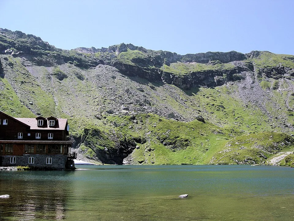

Overview
From Cabana Bâlea Lac, on the northeast shore of Bâlea Lake at 2,034 m, the blue-triangle trail leaves the lakeshore near the summer campground and climbs immediately, switchbacking up loose scree and rock steps toward Șaua Caprei, a narrow pass on the main Făgăraș ridge at 2,315 m. From the pass the trail gives its best panorama: turn north and Bâlea Lake sits cupped in its glacial cirque with the switchback ribbon of the Transfăgărășan visible beyond it, then turn east-southeast, mostly east, and Lacul Capra appears below, a smaller lake set in bare rock at the foot of Vânătoarea lui Buteanu and Vârful Capra. Beyond the pass the trail drops about 85 m on a stony path to Lacul Capra itself, a 2,230 m glacial lake fed by snowmelt from the surrounding peaks, with a smaller pool called Lacul Căprița forming a few meters downstream where the outlet leaves the lake. Two modest memorial markers near the shore recall hikers lost to avalanches in the basin, a reminder that this is high mountain terrain even on a summer afternoon. From Lacul Capra the route retraces its steps back over Șaua Caprei to Bâlea Lake, making the whole outing a short but genuinely alpine there-and-back that pairs well with a stop at the lake itself or the cable car down to Bâlea Cascadă.
At a glance
- Distance
- 3.7 km
- Time
- 2 hr 30 min
- Elevation
- ↑ 366 m · 2034–2315 m
- Route
- Out and back
Route and directions
Numbered markers trace the waypoints from the trailhead. Use the buttons to open the trailhead in an external map app for driving directions. Links open in a new tab.
Access, season, and cautions
Access
From Brașov, drive west on DN1/E68 toward Sibiu, then turn south onto DN7C, the Transfăgărășan, at Cârțișoara; it is roughly 135-140 km and, given the road's hairpin turns and a mountain-section average speed near 40 km/h, plan on about 2.5-3 hours of driving to reach Bâlea Lac. The high stretch of DN7C above Bâlea Cascadă is normally open only from around late June/early July to October, weather permitting, and is gated overnight; check current road status before setting out, since a rockfall or early snow can close it with little notice. Outside those months, or as a way to skip the closed upper switchbacks, a cable car connects Bâlea Cascadă to Bâlea Lac. Paid parking is available at Bâlea Lac and fills up on summer weekends, so arrive early.
No hiking permit or trail fee applies to the Șaua Caprei-Lacul Capra trail itself. Parking at Bâlea Lac is a paid lot (roughly 25 RON per day in season). It is worth telling the Salvamont mountain-rescue post at Bâlea Lac about your planned route before heading above the lake, given the basin's avalanche and lightning history.
Season: Hike between late June/early July and October, when the high section of DN7C and the trail itself are typically snow-free and Bâlea Lac's chalets are open; this is also the window when the Transfăgărășan is open to traffic above Bâlea Cascadă. July through September tend to have the most stable weather and the least residual snow on the pass, though sudden summer afternoon storms are common, so start early. Outside this window the route becomes a winter mountaineering line requiring crampons, an ice axe, and avalanche judgment — the slopes around Bâlea Lake were the site of Romania's deadliest avalanche in 1977, a reminder of the basin's off-season danger.
Cautions
- Loose scree and rock steps on the steep climb to Șaua Caprei are slippery when wet, and can ice over even in shoulder-season months
- Short stretches of trail near the saddle run close to steep drop-offs into the Bâlea and Capra valleys, which can unsettle hikers uneasy with exposure
- Weather changes fast above 2,000 m: fog, strong wind, and afternoon thunderstorms with lightning risk are common on the open pass in summer
- Snow and ice patches can linger on shaded parts of the trail into early summer even when Bâlea Lake itself is clear
- No potable water source along the route; carry all the water you need from Bâlea Lake
- The trailhead already sits above 2,000 m, so altitude effects such as breathlessness or headache are possible for hikers arriving quickly by car or cable car
Waypoints
- Cabana Bâlea Lac (trailhead) — Mountain hut and cable-car top station on Bâlea Lake's northeast shore; blue-triangle trail markers begin near the summer campground.
- Start of the climb — Trail leaves the lakeshore past the paid campground and begins climbing on loose rock.
- Steep switchback section — Steepest, most exposed stretch of the route, ascending scree and rock steps toward the pass.
- Șaua Caprei (Capra Saddle, 2,315 m) — High point of the route on the main Făgăraș ridge, with Bâlea Lake behind to the north and the Capra valley opening east-southeast.
- Lacul Capra (2,230 m, turnaround) — Glacial lake and turnaround point beneath Vânătoarea lui Buteanu and Vârful Capra; retrace the same trail back to Bâlea Lake.
Gallery
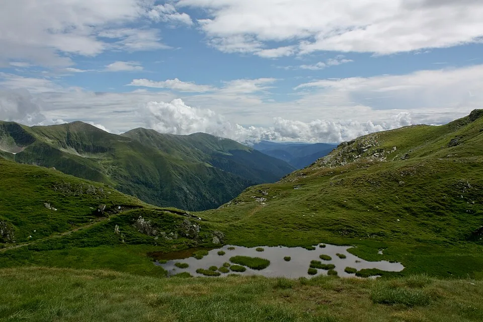
Făgăraş Mountains, Romania - Lake Capra — Mercy, CC BY-SA 3.0, via Wikimedia Commons · CC BY-SA 3.0 · Source
.jpg)
Sources
- Bâlea Lake (en, retrieved 2026-07-02)
- Lacul Capra (ro, retrieved 2026-07-02)
- Bâlea Lake - Caprei saddle hiking trail, Făgăraș mountains (en, retrieved 2026-07-02)
- Lake Bâlea - Lake Capra (en, retrieved 2026-07-02)
- Transfăgărășan (en, retrieved 2026-07-02)
- Șaua Caprei (saddle node) (en, retrieved 2026-07-02)